-
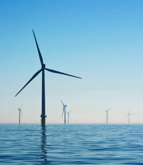 We offer detailed forecast systems and individual solutions, which we refine locally on the basis of high-resolution weather model data. Local conditions as well as live data from the respective power plants are included in our energy forecasts. This enables us to make precise energy forecasts for wind, solar and hydropower feed-in for different control areas and locations.
 -
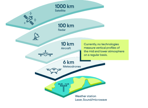 The specially developed, patented Meteodrones operated by our drone pilots offer the innovative possibility to collect weather data from the lower and middle atmosphere. With Meteodrones, it is possible for the first time to carry out high-resolution and direct measurements of temperature, humidity, air pressure and wind, to incorporate these into weather model calculations and thus demonstrably improve weather forecasts.
 -
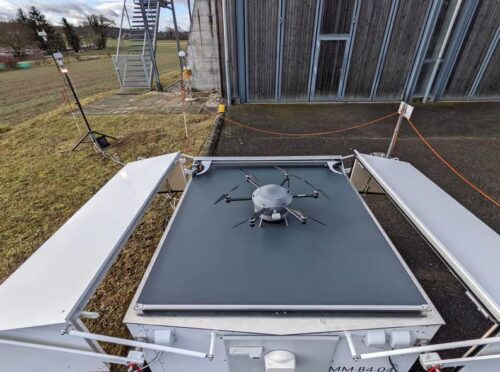 An important step towards nationwide drone deployment was the development of the Meteobase. It enables autonomous drone measurements and is also the drone's "home" from which it takes off, lands and its battery is charged. As a ground station, it serves as local support for the operation of the Meteodrones. It serves as a communication element between the pilot and the drone or works as a control element for autonomous flights of the drone. The Meteobase consists of a central computer that performs various tasks related to the operation, control and maintenance of the drone and the monitoring and logging of weather parameters at the site.
 -
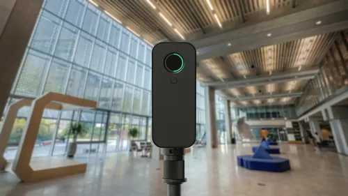 Digital twin capture reinvented, reimagined, and ready for whatever it takes.
Bigger spaces. Greater precision. Faster scans.
The Pro3 expands on everything you already love about our flagship Pro2 camera, allowing you to create incredibly accurate and immersive digital twins of any space, even outdoors.It transports the most authentic reality to the virtual world.
The new 20Mpx sensor with a 12-element wide-angle lens produces precise, detailed digital twins in vivid, lifelike colors that make you feel like you're really there.Indoors and outdoors, anytime.
Digital twins are no longer just limited to indoor spaces. Our innovative camera with LiDAR technology takes millions of measurements in both dim light and direct sunlight, allowing you to experience the great outdoors in immersive detail.Improved accuracy.
The Pro3 camera, coupled with our advanced cloud processing platform, delivers digital twins that are more accurate, detailed and lifelike than ever before.Incredible reach. Scans in record time.
Capturing 3D data from up to 100 meters away in less than 20 seconds per scan, the Pro3 speeds up the scanning process, freeing you up more time for collaboration.High-performance, high-precision LiDAR.
The Pro3's ultra-fast, high-precision LiDAR sensor can run for hours, is surprisingly compact, and takes millions of measurements in any condition.Designed for portability.
The Pro3 is lightweight and easy to carry throughout the day. With a simple battery change you can scan continuously for as long as you need. -
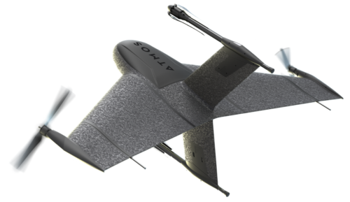
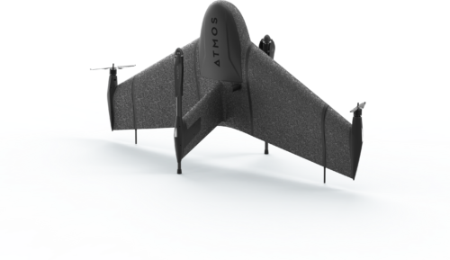
Marlyn Cobalt Plan with Precision.
See more, fly more, and do more with greater precision than any other VTOL drone.
Fly in the strongest winds, up to 45 km/h
With the Marlyn you can comfortably take off, inspect and land in winds of up to 45 km/h, more than any other inspection drone. Try our Wind Calculator to see how many more days you can survey with Marlyn.Operate from any 2x2m area
Take off like a helicopter and fly like a plane. With Marlyn you can operate from anywhere and cover up to 320Ha (790 Acres) per flight. You no longer have to search for large clear areas to land.Data capture with centimeter precision
To keep your customers satisfied, the best survey cameras from Sony and Micasense are combined with our top-of-the-line PPK from Topcon and a market-leading autopilot to give you accuracies down to 1cm.Designed and manufactured by the EU
To ensure high-end quality and ethical trading standards, we believe in keeping things local. That's why all our Marlyns are designed, created and assembled right here in the Netherlands.Authorized Dealer
-
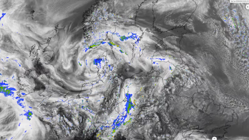 A numerical weather model calculates the current state of the atmosphere and the state of the future with the help of computers and on the basis of measured data, both locally measured and remotely sensed. Complex physical equations are used, which are calculated by high-performance computers with enormous power and processed into high-resolution weather forecasts.
Contact us:
Contact us
-
786-2223099
-
16969 NW 67 Avenue, Suite 208, Hialeah, FL 33015
-
1601 SW 102nd Avenue Miami, FL 33165
Products
- Land surveying
- Weather systems
- GIS and remote sensing
©Copyrigth 2021 • Made with pasion by VoBo Marketing