-
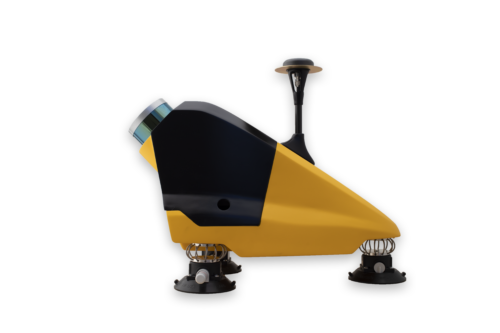 Designed to be easily swapped in minutes from vehicles to UAV. The YellowScan Fly&Drive is a versatile land vehicle-mounted or UAV-mounted mobile mapping system which combines high resolution laser scanning and precise positioning to collect geo-referenced point clouds for a wide range of applications.
 -
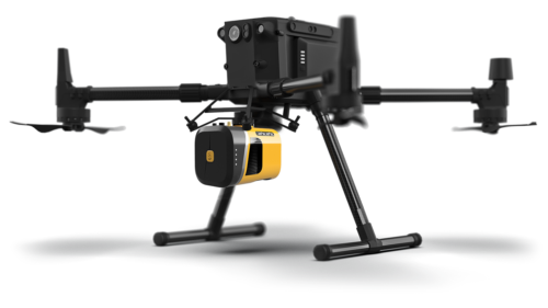 The new YellowScan Mapper+ can be mounted on a wide range of UAV platforms due to its low weight. The YellowScan Mapper+ integrates Livox AVIA laser scanner together with high performance GNSS-aided inertial navigation system into a lightweight, standalone and easy-to-use lidar system. Proven capabilities and stable results over a wide range of applications.
Contact us:
Contact us
-
786-2223099
-
16969 NW 67 Avenue, Suite 208, Hialeah, FL 33015
-
1601 SW 102nd Avenue Miami, FL 33165
Products
- Land surveying
- Weather systems
- GIS and remote sensing
©Copyrigth 2021 • Made with pasion by VoBo Marketing