-
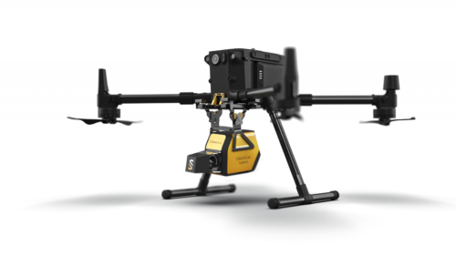 The YellowScan Explorer is the first LiDAR that can be mounted on a manned light aircraft or helicopter and switched to a UAV platform such as the DJI M300. This versatility allows the user to tackle a wide range of projects with the proven ease of use of YellowScan LiDAR UAV solutions.
 -
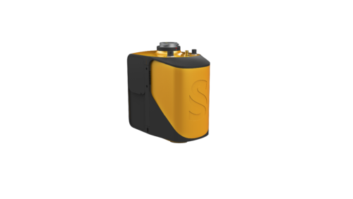 The new YellowScan Mapper is our Livox-based UAV LiDAR system. The YellowScan Mapper UAV LiDAR system is equipped with a high-performance Livox Horizon laser scanner from Livox, a DJI-backed company. With a great point density, this LiDAR sensor allows our LiDAR system to fly easily at 70m AGL with a 120m swath. We recommend a balanced 10 m/s flight speed to benefit from the Mapper’s point density while being productive. For example, flying at 70m AGL, 10 m/s, with 20% sidelap, you will be able to map 10 ha in 3 minutes. The YellowScan Mapper is the right LiDAR tool to start with. Your data collection will be fast, accurate and cost-effective.
 -
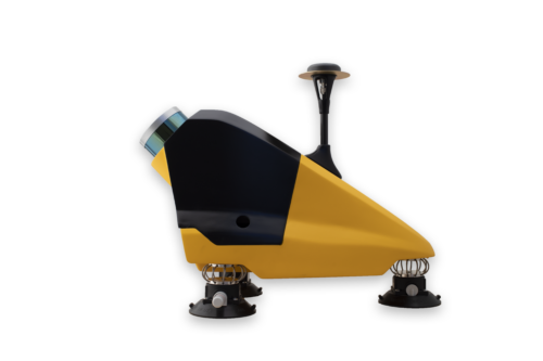 Designed to be easily swapped in minutes from vehicles to UAV. The YellowScan Fly&Drive is a versatile land vehicle-mounted or UAV-mounted mobile mapping system which combines high resolution laser scanning and precise positioning to collect geo-referenced point clouds for a wide range of applications.
Contact us:
Contact us
-
786-2223099
-
16969 NW 67 Avenue, Suite 208, Hialeah, FL 33015
-
1601 SW 102nd Avenue Miami, FL 33165
Products
- Land surveying
- Weather systems
- GIS and remote sensing
©Copyrigth 2021 • Made with pasion by VoBo Marketing